Severe Weather Could Hit Minnesota, Iowa, South Dakota Tuesday
Parts of Minnesota, Iowa, and South Dakota could see Tornados, Large Hail, Flooding, and big Wind.
According to the National Weather Service in Sioux Falls Storms are expected to develop in Southeast South Dakota in the early afternoon on Tuesday.
These storms are forecast to increase in intensity and move easterly into portions of Minnesota and Iowa.
Scattered thunderstorms are expected Tuesday as a cold front moves through the Sioux Falls tri-state area.
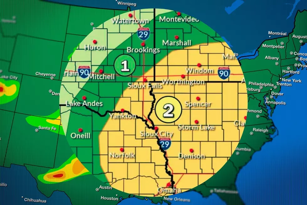
Scattered severe storms are possible, with a Level 2 of 5 risk for severe weather.
Large hail to the size of golf balls and damaging wind gusts to 70 mph are the primary threats, with a tornado and minor flooding from heavy downpours being the secondary threats.
The greatest risk (2/5) is for areas in and adjacent to northwestern Iowa, with a lower risk (1/5) extending along and south/east of a line from Marshall, MN to Mitchell, SD and down to Burke, SD.
7 Sucky Foods We Eat In South Dakota
Gallery Credit: Canva.com
More From KKRC-FM / 97.3 KKRC