More Snow For Parts Of Minnesota, Iowa, And South Dakota
Parts of southern Minnesota and South Dakota could see a few inches of snowfall Monday.
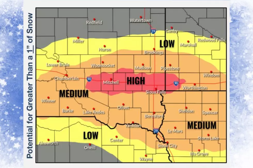
The National Weather Service in Sioux Falls says “Confidence continues to increase in accumulating snowfall returning to the area by Monday.

While amounts are still uncertain, some areas could see a few additional inches of snow with the highest potential expected along and south of I-90 corridor.'

The National Weather Service Forecast for the Sioux Falls, South Dakota area...
Monday: Snow, mainly after noon. High near 17. North wind 5 to 10 mph. Chance of precipitation is 90%. New snow accumulation of around 2 inches.

Monday Night: A 40 percent chance of snow before midnight. Cloudy during the early evening, then gradual clearing, with a low around -13. Wind chill values as low as -24. North wind 5 to 10 mph. New snow accumulation of less than one inch possible.
Tuesday: Mostly sunny, with a high near 7. North wind around 5 mph.
Tuesday Night: Mostly cloudy, with a low around -3. Calm wind.
Wednesday: A 20 percent chance of snow. Mostly cloudy, with a high near 14.
10 Wild South Dakota Snowstorms
Gallery Credit: KXRB
More From KKRC-FM / 97.3 KKRC


